
Rochester Neighbors Block Record Map
Start with the Rochester parcel, not a person name. The records below make a Rochester block readable by showing its physical boundaries, title or taxpayer roles, historic address patterns, and community labels. Each source from Rochester answers a smaller question. The public data for a Rochester block does not create a complete household list, and a Rochester map cannot identify every person who lives near a Rochester address.
| Source | What It Shows About a Block | Access |
|---|---|---|
| Rochester GIS parcel map | Rochester adjacent geometry, streets, rights-of-way, districts, and city limits | Rochester public map and ArcGIS layer; click, buffer, and select |
| Rochester iasWorld property record | Rochester parcel ID, owner or taxpayer, situs, mailing, legal, and tax context | Free Rochester current certified assessment; not an occupant list |
| LandShark records for Rochester | Rochester recorded title relationship and legal-description trail | Paid index, images, and copies; historic online cutoff not located |
| Rochester city permits and directories | Rochester address work history or historical address-to-person pattern | Citizen Access and RPL collections; coverage varies |
| Rochester civic associations | Rochester community contacts, park ties, and neighborhood identity | City community inventory; no public member directory found |
Olmsted County describes a Rochester assessment landscape of about 76,000 parcels, which makes Rochester parcel context more dependable than a broad assumption about a Rochester block. A tax mailing address is a delivery field, not proof that someone occupies the physical situs. Label a Rochester result as owner, taxpayer, applicant, or historical subject, then compare it only with Rochester sources that can independently support the next question.
Map Rochester Neighbors Parcel First
The iasWorld Map Search for Rochester is the practical starting point for the immediate Rochester block. Search the Rochester target address, click its parcel, and inspect the polygons that actually touch or sit nearby. A road, alley, rail line, river, or nonresidential parcel can break the social idea of a Rochester neighbor even when shapes look close on screen.
- Locate the Rochester address and identify its selected Rochester parcel before expanding the view.
- Inspect surrounding polygons, street centerlines, city limits, and any physical break in the Rochester block.
- Set a small distance and units value, choose parcel center points or polygons, then use Select By Buffer.
- Open the current list for Rochester and review each selected parcel through its property record.
- Save a dated Rochester map printout with title, scale or extent, legend, and source information.
The screenshot of the Rochester iasWorld map controls shows the Rochester map-first route used for a Rochester neighbors search.
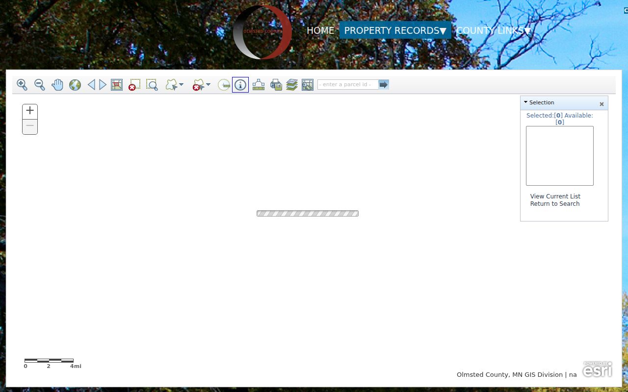
The map's Timing, Distance, Units, Buffer using, Select By Buffer, View Current List, and Return to Search keep the selected set tied to the actual Rochester map geometry. For a full Rochester named-street record chain rather than an immediate block, use the Rochester street directory.
Read Rochester Neighbor Parcel Fields
For every selected Rochester parcel, record the parcel ID, owner or taxpayer, situs address, mailing address if shown, legal description, city or township, and tax context. The public notification parcel layer for Rochester includes Section, Township, Range, OwnUnitNo, OwnUnitDes, PrimOwner, and geometry. Those fields form a bridge from a polygon to a Rochester property record. They are not a profile of all people at the Rochester address.
The Rochester Olmsted public notification tax-parcel layer documents the queryable Rochester parcel schema used in block work.
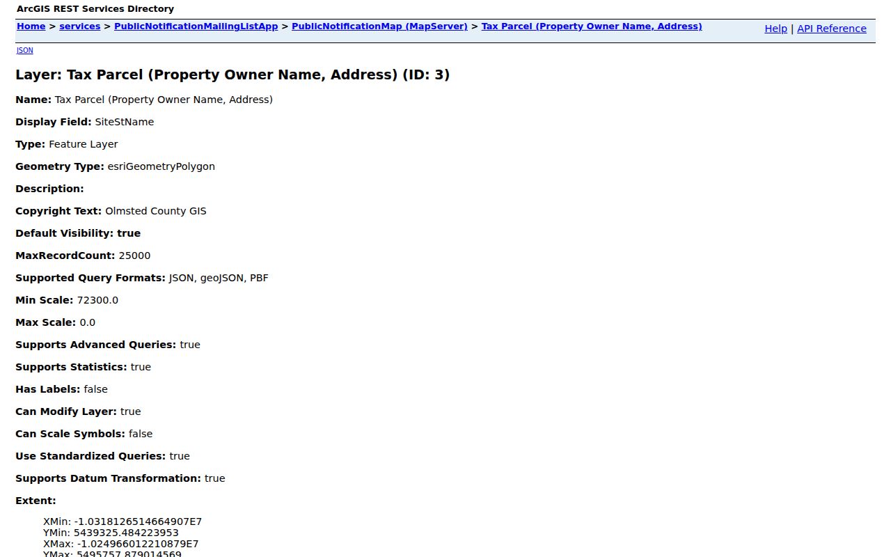
Use the Rochester map result to open the free Rochester iasWorld property search, then preserve both Rochester mailing and situs labels. A Rochester parcel may have a single owner while holding multiple units, or it may show a mailing destination elsewhere. That makes Rochester property ownership an evidence point, not a count of nearby household members.
Set Rochester Block Boundaries
Map geometry deserves a second look before any names are compared. Use county GIS layers for city limits, address points, street centerlines, current or recent imagery, zoning, and districts when they help explain a boundary. The county also keeps a retired-address layer with MSAG community and legacy street-name fields. That is useful when older labels and the present parcel map do not line up.
Rochester's quadrant system uses Broadway and Center as axes, so the compass suffix belongs in the address notes. Former street names, a legal description, and parcel ID can bridge a change without pretending that a modern number and an older printed address are automatically identical. A printout should have a date, extent, legend, and source note so another person can reproduce the same block snapshot.
Note: A small buffer is a starting set, not a rule that every selected parcel is a social neighbor.
Separate Rochester Neighbors From Occupants
Property owner, taxpayer, legal-title party, and tax mailing contact are meaningful record roles. None proves current occupancy. Homestead status can be an ownership-related tax clue, but it is not conclusive evidence that a particular person currently lives at the situs. A permit can identify an applicant, owner, or contractor and still say nothing about every household member.
The same limit applies across public systems. Utility customer information is not a public block source, and driver-license address data is restricted. A court record can show a party role but hides party street addresses in MCRO. Treat each source as a dated association with a parcel or event, rather than trying to assemble a complete list of Rochester neighbors from fragments.
Follow Rochester Voter Record Limits
MNVotes can verify a known person's registration match when the name, date of birth, and address inputs fit the official lookup. It does not offer an anonymous street-wide or block-wide household search. Its nightly update also means a nonmatch has several possible explanations, including an input issue, normal processing, protected status, or no registration.
Minn. Stat. §201.091 controls the public voter list. A registered Minnesota voter can use the state's certified request process for certain geographic lists, including a walking-list format, but the material is not an open web export and cannot be published as a searchable block roster. Respect the stated purpose and handling rules before requesting any voter information.
Find Rochester Civic Community Contacts
Rochester's city volunteer material names real community groups and park ties. It is a civic-contact inventory, not a membership or HOA directory. The inspected city source did not expose public member lists, universal boundaries, or common join instructions. Do not infer that a parcel owner, map result, or voter record belongs to any group.
| Rochester community name | What the city inventory supports |
|---|---|
| Eastside Pioneers Neighborhood Association | Neighborhood identity and a civic connection to Martin Luther King Jr. Park and Mayo Park/Buffalo Wallow |
| Lowertown Neighborhood Association and Silver Lake-West | Community labels connected in the city volunteer material |
| Arborglen Neighborhood Association | Civic identity associated with Arborglen Park |
| Stonehedge Collaborative and Friends of Northern Heights Park | Named community or park-support contacts, not verified household rosters |
| Friends of Indian Heights Park and Friends of Baihly Meadows Park | Park-focused civic groups listed by the city |
Use the City of Rochester volunteer and community route, public meeting agendas, or an individual organization's official contact path for a specific civic question. The inventory supports neighborhood names and activity, not a conclusion about who belongs to a group.
The same city material also names civic partners such as Cardinal of Minnesota, Sertoma Club, Kiwanis, VFW Post 1215, and Rochester Running Club. Those names can help distinguish a park sponsor, service group, or activity partner from a neighborhood association. They do not establish where anyone lives, who participates, or the limits of a neighborhood.
Compare Rochester Neighbor Source Types
Official parcel and civic sources have a narrow, stated role. Commercial neighbor-search categories combine public filings, marketing data, licensed data, and inferred links. They can carry stale entries, merge people with similar names, and repeat old addresses without saying which record created the match. Paid access does not make a result official.
| Source type | Best use | Critical boundary |
|---|---|---|
| County GIS and iasWorld | Map geometry and current parcel-owner or taxpayer context | Does not prove occupancy or list every household member |
| Recorded documents | Title and legal-description trail | Paid access can apply; title is not a resident roll |
| City civic inventory | Community names and public contact starting points | Not a membership directory |
| Commercial compilations | Unverified lead for a source to check elsewhere | Can be stale, merged, or context-free |
If a commercial profile is inaccurate, use its own removal route and retain the confirmation date. For official data, send the correction request to the office that holds the record. The two correction paths are different because a public deed or parcel field follows the custodian's authority, not a compiler's profile process.
Protect Rochester Neighbors and Records
Minnesota chapter 13 has a public-data presumption, but records-specific laws make some information private or nonpublic. Safe at Home uses a designated address for a person facing a safety threat, and voters can seek withholding or inactivation procedures. Do not use a tax mailing address, deed, or map pattern to try to identify a protected person's actual location.
Lawful use. Rochester neighbors records support personal, lawful civic and property research. Minnesota's anti-stalking law, Minn. Stat. §609.749, prohibits using a record trail to stalk, harass, intimidate, or expose another person.
LandShark rules also prohibit data mining, mass downloading, and unauthorized redistribution. Court and vital material can be restricted, and a protected voter may not appear in the way an unprotected record would. When a block question requires more than map and parcel data, contact the proper custodian or civic organization without asking staff to disclose private information.