
Rochester Previous Residents by Era
Begin a Rochester inquiry with the source that matches the question. The Rochester assessor provides a current parcel anchor, not a complete history. A Rochester recorded deed follows legal title. Rochester directories and census material add household evidence, while Rochester maps establish the building and address setting. Several local ranges remain unconfirmed, so an honest Rochester trail records an unknown start or end rather than filling it with a guessed year.
| Rochester source | Years or coverage | Where it is held | What it contributes |
|---|---|---|---|
| Rochester LandShark recorded index | Rochester online start year not located | Rochester Olmsted Recording & Abstracting and LandShark | Rochester recorded parties, document date and number, legal description, paid image access |
| Rochester iasWorld assessment record | Rochester current certified assessment; historic cutoff not located | Rochester Olmsted PRL portal and office | Rochester current tax owner, situs and mailing context, parcel and legal clues |
| Rochester city directories | Exact Rochester local run not located | Rochester RPL and ResCarta | Historical Rochester address-to-occupant and household notation |
| Rochester newspapers | Rochester 1859 to 1925; Post Bulletin microfilm from 1925 | Rochester Minnesota Digital Newspaper Hub and RPL | Rochester moves, notices, obituaries, family and civic context |
| Rochester Sanborn maps | Rochester 1884 through a bound 1928 to 1948 run | Rochester MNHS map access | Rochester footprint, use, street layout, and building change |
| Rochester census indexes | Minnesota material 1849 to 1905; Rochester federal release follows a 72-year rule | Rochester MNHS, NARA, and authorized research services | Rochester household snapshot, age, birthplace, and locality |
For a recent Rochester title question, start with the parcel and deed. For a Rochester household question, begin with the closest directory year and then test it against census, newspaper, and title evidence. The Rochester sources should agree where they overlap, but they should never be forced to say the same thing.
Freeze the Rochester Address First
Before tracing Rochester past residents, make a private Rochester research card for the known address. Save the modern Rochester spelling, quadrant, ZIP verified by USPS, parcel ID, situs, tax mailing address, owner or taxpayer, legal description, section-township-range, and any subdivision, lot, or block wording. Add current and retired Rochester street-layer names, map date, permit number, deed document number, directory year, and source URL as each item appears.
This prevents one of the most common Rochester mistakes: treating a tax mailing destination as the place where someone lived. It also preserves the Rochester key needed when a parcel is divided or a historic document uses a former street name. The Rochester legal description, not the delivery label, is the best title anchor when the record trail changes shape.
Trace Rochester Previous Residents Through Deeds
Rochester title evidence begins with the current Rochester iasWorld record, then moves to the Rochester recorded instrument. Search the current Rochester owner as grantee, the party who received title, and identify the seller as grantor. Search that seller as an earlier Rochester grantee. Repeat this pattern only while the legal description still matches. A Rochester deed chain tracks ownership, so it should not be presented as a list of everyone who lived at the address.
- Retrieve the current Rochester parcel record and copy the owner or taxpayer name, situs, mailing address, parcel ID, and legal description.
- Search Rochester LandShark for the instrument where the current owner is grantee. Record names exactly as printed, including initials, trust, entity, or spouse wording.
- Log the document type and number, recording date, execution date, legal description, book or page or certificate reference, and image or copy status.
- Use the seller or grantor as the next grantee search. Check spelling variants and compare the legal description before accepting the link.
- When a plat, split, or changed legal description appears, follow that land record instead of assuming the street number is continuous.
- Grantor
- The party transferring an interest in a recorded instrument, often the seller in a deed.
- Grantee
- The party receiving the interest. In a backward title search, this is the name used to locate an earlier purchase.
- Chain of title
- The sequence of recorded transfers connecting one title party to the earlier one.
- Legal description
- The lot, block, subdivision, section, or metes-and-bounds language that identifies land for title purposes.
When Rochester LandShark Stops
Olmsted Recording & Abstracting's research and copy information explains the online and office routes. LandShark is a paid research product. An occasional user pays a $3 convenience fee, plus $1 for a detail page, $1 for the first document page, and $0.50 for later pages. Subscriber pricing differs, and certificate-of-title retrieval has a separate charge. These amounts are access costs, not a promise that every historic instrument is online.
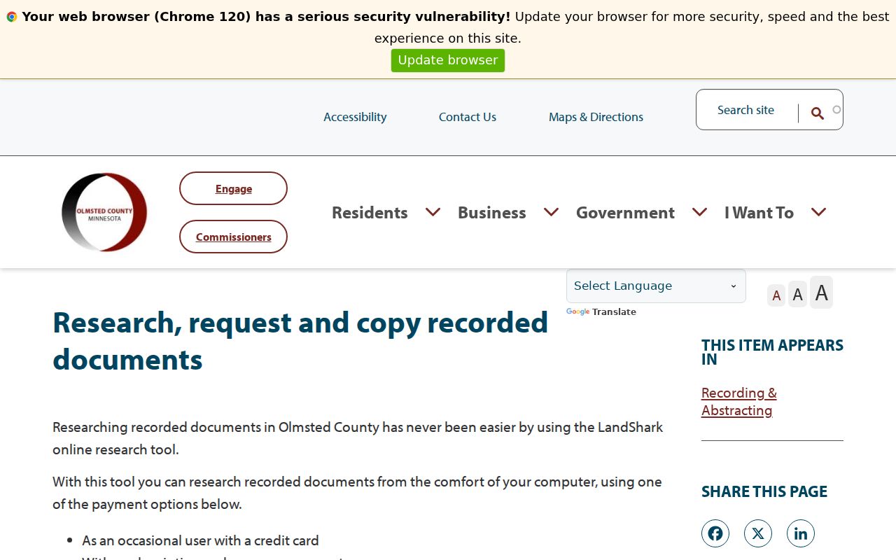
The exact LandShark online beginning year was not located in official county material. At the first missing link, ask Recording & Abstracting about older deed books, abstract or title records, staff research, and page or certification copies. County staff research is listed at $75 per hour; copies and certified copies have separate fees. A stopped index is a reason to change access channels, not a reason to invent an owner sequence.
Rochester Maps Date the Building
Sanborn maps supply the built-environment side of a previous-residents search. Minnesota Historical Society's list records Rochester editions from September 1884, June 1890, June 1899, June 1904, April 1909, June 1914, October 1920, and March 1928, followed by a bound March 1928 to November 1948 run. Compare the map's footprint, use, street layout, and name with the directory and deed window.
A map can show that a number referred to a commercial building, a duplex, or a changed footprint. It cannot identify residents. That makes it a useful check against a false continuous-occupancy story, especially where a street label changed while the building remained.
Rochester's 1918 Address Shift
Rochester adopted its quadrant system on July 9, 1918. Broadway divides east and west, and Center Street divides north and south. Earlier records may use names that the current GIS does not expect. The city street-name chapter connects older southwest labels, including Main, Franklin, Prospect, Grove, and Court, with later avenue relationships. It also records the 1992 13th Avenue SW change in Bamber Ridge Second Subdivision.
Search the old name and current name together with the number, direction, parcel, and legal description. The county GIS retired-address layer keeps legacy street-name and MSAG community fields, which can expose a continuity problem. A historic address should be treated as a research lead until a plat or jurisdiction record connects it to the modern parcel.
Rochester House-History Research Routes
Rochester Public Library's Rochester History resources provide a local route for directories, newspapers, microfilm, maps, and digital history. The library's local-history room is at 101 2nd Street SE, and the local-history phone is 507-328-2309. RPL's current ResCarta portal includes a City Directories collection, but its individual item dates vary and the portal is being refreshed in 2026.
For a targeted archive question, HCOC's Wicklund Archives accepts house-history and architecture research by appointment or remote request. Send the address, legal or situs variants, approximate construction period, and known owners before ordering copies. HCOC lists remote contact through 507-282-9447 and archivist@olmstedhistory.com, with a $25 hourly staff-research rate and a $10 minimum. That focused request is more useful than asking an archivist to guess at an address history.
Rochester Previous Residents in Directories and Census
Title parties are only one layer of an address history. Rochester city directories can connect an address with a historical occupant, and census material provides a household snapshot. RPL and ResCarta hold the local directory collection, but the exact complete print run and reverse-directory years have not been located publicly. Confirm the edition and scan rather than treating an empty search as proof that no one lived there.
- Find the directory edition nearest the date at issue and search the name, address, or criss-cross portion for the number and nearby numbers.
- Record the spelling, initials, household notation, address, and the edition date. Keep the quadrant suffix and historic street label exactly as printed.
- Bracket a move with directory editions on either side, then compare the window with the appropriate census period and the deed chain.
- Use newspaper notices, RPL's Obituary Finder, and probate records as later evidence of moves, death, heirs, or a final known address.
The Rochester Directory Book focuses on the local collections. Here, a directory entry matters because it tests who lived here before against the date range established by land records and maps. A census is a snapshot, not an annual address roll, so its location and date should stay visible beside the name.
Personal research only. Do not use Rochester previous-resident information to track, harass, intimidate, or harm a living person. Keep each result tied to its source, role, and date.
Separate Rochester's Two Clocks
Rochester address history has a legal clock and a built-environment clock. Deeds, assessments, and permits document title or administrative events. Plats, Sanborn maps, aerials, street-name changes, and retired-address layers document what happened to the land and building. A person can vanish from a directory while a building remains, and a parcel can split while the street number still looks familiar.
Use past-resident records for family history, house history, estate questions, and personal curiosity. Names and addresses in older sources deserve the same care as current records. Each conclusion should say whether it reflects a deed party, tax record, directory occupant, archive finding, or a map date.